English
 Français
  Italiano
  Deutsch
 - FURNITURE
-
Featured item
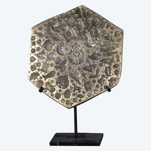
 Very important jewelry matrix – India
800 € EUR
Very important jewelry matrix – India
800 € EUR
-
Featured item
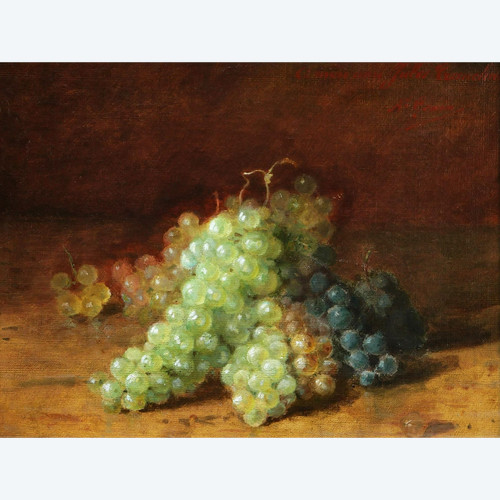
Amédée GENIN, Bunches of grapes
850 € EUR