English
 Français
  Italiano
  Deutsch
 - FURNITURE
-
Featured item
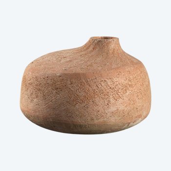
 Large Terracotta Vase, France, 1960s
490 € EUR
Large Terracotta Vase, France, 1960s
490 € EUR
-
Featured item
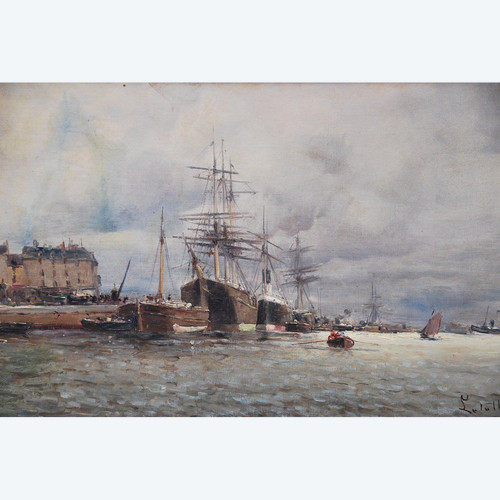
View Of Rouen, Oil Signed De Letellier
1.350 € EUR